


By David Heighway, Hamilton County Historian
If you’ve read much Indiana history, you’ve heard about the attempts to build canals and the failures that resulted. One of the classic stories is that of the Central Canal which only now exists in two sections between Broad Ripple and the Canal Walk in Indianapolis. However, there was also some digging done here in Hamilton County, traces of which may still be seen today.
The canal projects came about because of the Mammoth Internal Improvements Act of 1836 passed by the Indiana State Legislature. This act was to build new transportation routes for settlers coming into the area. However, it created too many projects which were begun simultaneously and failed at the same time the United States was having a financial crisis. It all ended with the state going bankrupt in 1839. The canals were still being discussed into the 1840s but were eventually abandoned. In his 1901 history of Hamilton County, Augustus Finch Shirts said, “Evidence of this work is to be found at many points in the county”. So, what is left to see?
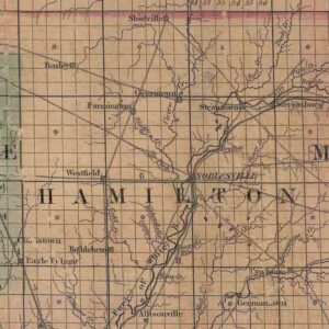
1838 Colton map, Library of Congress
Something that is a huge help in discovering the actual route is an article that appeared in the Noblesville Ledger on March 19, 1928. It was about a group of nature lovers who followed the old line during a birdwatching trip. The article says they were using visible remains as guideposts. It gives a very precise description of the properties that they passed though, which can be traced easily using the 1922 and 1933 plat maps of the county.
A town named Chillicothe was planned along the canal near the present-day intersection of Highway 13 and Strawtown Avenue. According to a 1944 Noblesville Ledger article, it was laid out in 1838 by Jonathan Hougham and David Provolt to take advantage of the canal. However, only seven lots were sold before the project failed. The successful community of Perkinsville was founded on the other side of the county line and north of White River in 1839.
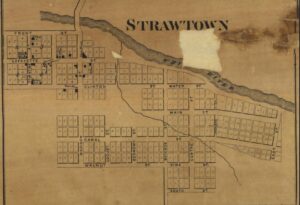
1866 map of Strawtown depicting Canal Street
Early maps show the route of the canal following the White River to Noblesville, which is probably not accurate. The first physical remnants can be found at Lafayette Trace Park where the path began to turn southwest. The canal route would have gone through Stevensburg (or Stephensburg as it was sometimes spelled), which was an early community near the intersection of Strawtown Avenue and Prairie Baptist Road. Strawtown itself is shown as having a Canal Street on the 1866 map of the county. The street would have connected with the canal east of town and south of Stevensburg.

Musselman Ditch
Continuing south, the town of Wheatly was platted near the present-day intersection of 206th Street and Olio Road. According to another 1944 Ledger article, it was laid out in 1839. Locks were built and land set aside for craftsmen, but it too failed and disappeared. Interestingly, an 1882 Ledger article said that a drainage ditch was being dug through Wayne Township along the old canal route. That watercourse is possibly the one known today as the F. M. Musselman Ditch, which begins at this intersection. This ditch could be the most notable remnant of the canal.
A quarry was established in Wayne Township in 1836 for cutting sandstone blocks to use in bridges and aqueducts. After the canal failure, the stone was sold to use in buildings in town. Most of the evidence suggests the quarry may have been where Stony Creek crosses 191st street near Union Chapel Road. In Riverside Cemetery today, there is a block that was supposed to have been used for the canal. It may have come from this quarry.
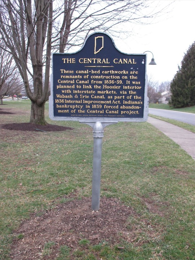
Historic Marker in Meadows neighborhood
The only identified remains of the canal are at the Meadows subdivision near the intersection of 191st Street and Highway 37. There is a historic marker on a street called Canal Way, and there are a series of parallel depressions in the ground that suggest canal locks.
The canal came through the area now occupied by Noblesville High School, went around the west side of the hill that now has Crownland Cemetery, and crossed Monument Street at present-day 15th Street. It paralleled the river through town, passing Courthouse Square through the site of the Judicial Center and running on the east side of the oldest section of Riverside Cemetery. Augustus Shirts talks about a flood in 1847 when the old ditches filled with water. The canal ditch at Riverside was later filled in and now has graves in it.

Canal remnants in Meadows neighborhood
The canal route was to have continued south and have gone through “Connerstown”, the community around William Conner’s trading post (now the site of Conner Prairie). It then would have eventually connected with the section built at Broad Ripple.
So, there are some visible remnants of the system, and there may be more that haven’t been recognized yet. As the county continues to grow and expand its transportation systems, it’s always interesting to compare them to what has gone before.